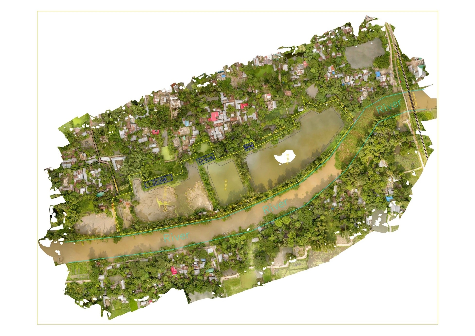
- Project Name: Topographic Survey and 3D Modeling using Drone
- Project Timeline: 2021-2022
- Client: Baiya Group
- Scope: Conducting a topographic survey and creating a 3D model of a 23-acre land using drones.
Key Points:
- Client Requirement: Baiya Group tasked INSIDE ENGINEERING with conducting a topographic survey and creating a 3D model of their 23-acre land.
- Innovation: Utilizing drone technology for aerial data collection to enhance accuracy and efficiency of the survey and modeling process.
- Project Objectives: To generate detailed topographic data and create a precise 3D model for various applications, including land development, planning, and visualization.

Project Deliverables:
- Topographic Survey: Conducted a comprehensive topographic survey using drones equipped with high-resolution cameras and LiDAR technology to capture accurate elevation data and terrain features.
- Data Processing: Processed the aerial data to generate digital elevation models (DEMs), contour maps, and other topographic data sets.
- 3D Modeling: Utilized the collected data to create a detailed and realistic 3D model of the entire 23-acre land, including terrain, vegetation, and structures.
Outcome:
- Accurate Data: The topographic survey and 3D modeling produced highly accurate and detailed representations of the land, enabling informed decision-making and precise planning.
- Visualization: The 3D model provides stakeholders with a visual representation of the land, facilitating better understanding and communication of project objectives and design concepts.
Conclusion:
- The Topographic Survey and 3D Modeling project demonstrate INSIDE ENGINEERING’s commitment to leveraging cutting-edge technology to deliver precise and innovative solutions for land surveying and visualization needs.
Next Steps:
- Presentation of survey findings and 3D model to the client for review and further utilization in land development, planning, and decision-making processes.


